Platform: Traffic Information Austria (VAO)
Coverage area: Austria – The VAO traffic information is used in journey planners by a variety of platforms, among them; AnachB.at, the motorway operator ASFINAG and 9 other institutions. VAO is offered as a stand-alone traffic information platform, but also serves as the basis for the respective traffic information provided by its partners.
Stakeholders: VAO is a collaborative project of ASFINAG (coordinator), the working group of Austrian transport association organisers (ARGE ÖVV), ITS Vienna Region, Ö3 traffic editorial staff, ÖAMTC, the City of Graz as well as the federal provinces of Burgenland, Carinthia, Lower Austria, Salzburg, Styria, Tyrol and Vienna. Co-opted partners are Austro Control, the Austrian Association for Rehabilitation (ÖAR), the Austrian Federal Ministry of the Interior and the Federal Province of Upper Austria.
Organisation and management:
Source of funding: 50% are subsided by the Climate and Energy Fund. The other 50% are paid by the stakeholders involved in the project, such as the provinces and the cities. For example, the state of Upper Austria funds the project to develop a real-time traffic overview of the states of Upper Austria and Salzburg.
Initial investment: The VAO project has a total financing volume of EUR 4.700.000. and was made possible by the Climate and Energy Fund, receiving a 50% subsidy under the framework programme “Public Transport”. The VAO II – a second phase to improve the project by use of additional data, optimisation of detection of traffic data and real time data, and integration of new mobility services (sharing concepts). Also, improving usability and performance of end-user services was targeted – project has a total financing volume of EUR 9.800.000, and also receives a 50% subsidy of the Climate and Energy Fund under the framework programme “Public Transport”.
Development history: The VAO is a project that started September 2009, with the launch of the journey planner in the summer of 2014. The VAO II project had the goal to further improve the services. The VAO II project started in 2012 and finished in mid-2015.
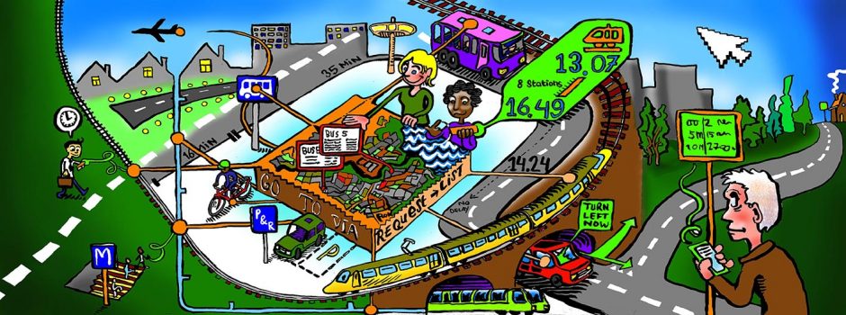
Modes of transport included: bike, foot, car, bus, train, metro, tram and airplane.
Service Features: The journey planner provides: (i) intermodal Austrian-wide door-to-door routing; (ii) comparison of travel times and environmental aspects of the trip.; (iii) public transport timetables; (iv) real-time and forecast of traffic situation;(v) information on Park&ride and Kiss&ride facilities, parking areas; (vi) map information and alerts related to roadworks, detours and traffic problems. The platform’s advice is neutral – there is no preference or discrimination of individual transport companies.
Source of data: VAO is based upon: (i) GIP.at and GIP.gv.at are the source for digital map for routing – authorized by federal states, ASFINAG, ÖBB Infrastructure; (ii) Basemap.at for background map tiles – source: GIP and geographical data; (iii) all data from its partners.
Data flow: The core component is a public database: the Graph Integration Platform (GIP) which enables the different partners to maintain and share content in partial networks.
Open data policy: N/A
Continuity: N/A